


Middlesex County PUMA, Connecticut
About
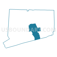
Outline

Summary
| Unique Area Identifier | 192514 |
| Name | Middlesex County PUMA |
| State | Connecticut |
| Area (square miles) | 439.06 |
| Land Area (square miles) | 369.30 |
| Water Area (square miles) | 69.76 |
| % of Land Area | 84.11 |
| % of Water Area | 15.89 |
| Latitude of the Internal Point | 41.43452510 |
| Longtitude of the Internal Point | -72.52422670 |
Maps

Graphs
Select a template below for downloading or customizing gragh for Middlesex County PUMA, Connecticut


Neighbors
Neighoring Public Use Microdata Area (by Name) Neighboring Public Use Microdata Area on the Map
- East Haven, Branford, Guilford, Madison & North Branford Towns PUMA, CT
- Glastonbury, Newington, Wethersfield, Rocky Hill & Marlborough Towns PUMA, CT
- Meriden, Wallingford & North Haven Towns PUMA, CT
- New Britain, Berlin & Plainville Towns PUMA, CT
- New London County (North) PUMA, CT
- New London County (South) PUMA, CT
- Suffolk County (East) PUMA, NY
Top 10 Neighboring County (by Population) Neighboring County on the Map
- Suffolk County, NY (1,493,350)
- Hartford County, CT (894,014)
- New Haven County, CT (862,477)
- New London County, CT (274,055)
- Middlesex County, CT (165,676)
Top 10 Neighboring County Subdivision (by Population) Neighboring County Subdivision on the Map
- Meriden town, New Haven County, CT (60,868)
- Middletown town, Middlesex County, CT (47,648)
- Wallingford town, New Haven County, CT (45,135)
- Glastonbury town, Hartford County, CT (34,427)
- Guilford town, New Haven County, CT (22,375)
- Southold town, Suffolk County, NY (21,968)
- Berlin town, Hartford County, CT (19,866)
- Rocky Hill town, Hartford County, CT (19,709)
- Madison town, New Haven County, CT (18,269)
- Colchester town, New London County, CT (16,068)
Top 10 Neighboring Place (by Population) Neighboring Place on the Map
- Meriden city, CT (60,868)
- Middletown city, CT (47,648)
- Portland CDP, CT (5,862)
- Lake Pocotopaug CDP, CT (3,436)
- Clinton CDP, CT (3,368)
- Durham CDP, CT (2,933)
- East Hampton CDP, CT (2,691)
- Essex Village CDP, CT (2,495)
- Deep River Center CDP, CT (2,484)
- Westbrook Center CDP, CT (2,413)
Top 10 Neighboring Elementary School District (by Population) Neighboring Elementary School District on the Map
- Essex School District, CT (6,683)
- Marlborough School District, CT (6,404)
- Deep River School District, CT (4,629)
- Salem School District, CT (4,151)
- Chester School District, CT (3,994)
Top 10 Neighboring Secondary School District (by Population) Neighboring Secondary School District on the Map
Top 10 Neighboring Unified School District (by Population) Neighboring Unified School District on the Map
- Meriden School District, CT (60,868)
- Middletown School District, CT (47,648)
- Wallingford School District, CT (45,135)
- Glastonbury School District, CT (34,427)
- Guilford School District, CT (22,375)
- Berlin School District, CT (19,866)
- Rocky Hill School District, CT (19,709)
- Madison School District, CT (18,269)
- Colchester School District, CT (16,068)
- Regional School District 17, CT (14,871)
Top 10 Neighboring State Legislative District Lower Chamber (by Population) Neighboring State Legislative District Lower Chamber on the Map
- Assembly District 1, NY (149,382)
- State House District 33, CT (25,889)
- State House District 29, CT (25,554)
- State House District 48, CT (25,194)
- State House District 31, CT (25,136)
- State House District 32, CT (24,842)
- State House District 55, CT (24,373)
- State House District 83, CT (23,874)
- State House District 30, CT (23,809)
- State House District 35, CT (23,685)
Top 10 Neighboring State Legislative District Upper Chamber (by Population) Neighboring State Legislative District Upper Chamber on the Map
- State Senate District 1, NY (341,254)
- State Senate District 9, CT (104,736)
- State Senate District 4, CT (104,052)
- State Senate District 13, CT (101,659)
- State Senate District 34, CT (98,485)
- State Senate District 33, CT (98,002)
- State Senate District 12, CT (96,990)
- State Senate District 20, CT (96,786)
- State Senate District 6, CT (96,421)
- State Senate Districts not defined, CT (0)
Top 10 Neighboring 111th Congressional District (by Population) Neighboring 111th Congressional District on the Map
- Congressional District 2, CT (729,771)
- Congressional District 5, CT (714,296)
- Congressional District 3, CT (712,339)
- Congressional District 1, CT (710,951)
- Congressional District 1, NY (705,559)
Top 10 Neighboring Census Tract (by Population) Neighboring Census Tract on the Map
- Census Tract 5901, Middlesex County, CT (8,346)
- Census Tract 4903.02, Hartford County, CT (8,249)
- Census Tract 1712, New Haven County, CT (8,018)
- Census Tract 1942.01, New Haven County, CT (7,837)
- Census Tract 7141.03, New London County, CT (7,534)
- Census Tract 5851, Middlesex County, CT (7,388)
- Census Tract 4001, Hartford County, CT (7,195)
- Census Tract 1862, New Haven County, CT (7,098)
- Census Tract 6801, Middlesex County, CT (6,938)
- Census Tract 6802, Middlesex County, CT (6,726)
Top 10 Neighboring 5-Digit ZIP Code Tabulation Area (by Population) Neighboring 5-Digit ZIP Code Tabulation Area on the Map
- 06457, CT (47,648)
- 06492, CT (45,241)
- 06450, CT (36,493)
- 06437, CT (22,375)
- 06067, CT (19,709)
- 06037, CT (18,565)
- 06443, CT (18,269)
- 06415, CT (16,857)
- 06416, CT (14,005)
- 06413, CT (13,235)